Appearance
Setup
The Setup section allows administrators to change the map's initial appearance.
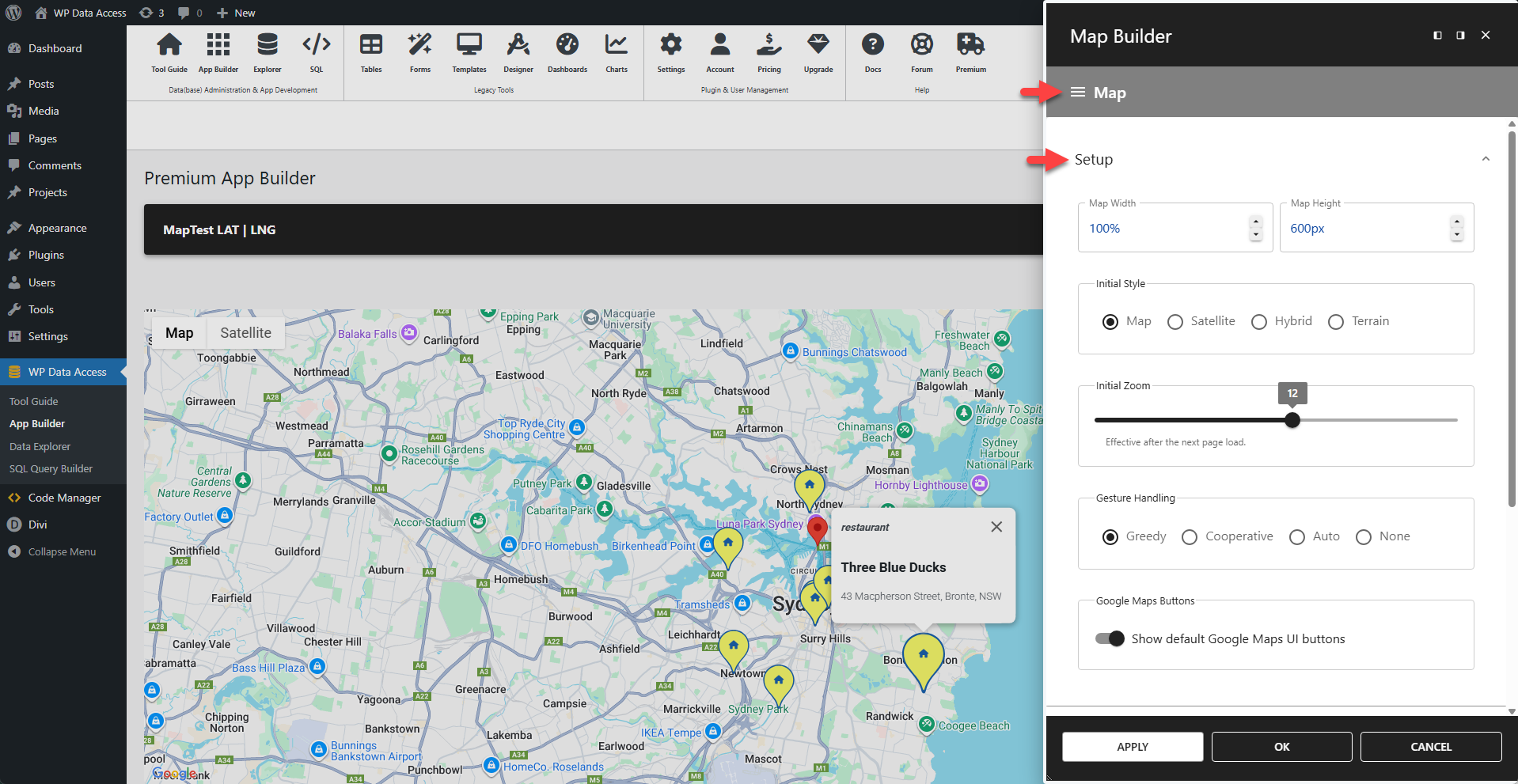
Map Dimensions
Dimensions can be defined as relative or absolute. These dimension settings are overridden when the user switches to full-screen mode.
⚙️ Map Width
Configures the map container width.
⚙️ Map Height
Configures the map container height.
⚙️ Initial Style
- Map - Displays the default road map view.
- Satellite - Displays photographic satellite images.
- Hybrid - Overlays road and feature names on satellite images.
- Terrain - Displays a physical map based on terrain information.
⚙️ Initial Zoom
Sets the default zoom level when the map first loads. Lower values (e.g., 1) show the whole world, while higher values (e.g., 20) show buildings and streets in close detail.
⚙️ Gesture Handling
- Greedy - The map exclusively responds to all gestures, preventing any page scrolling when interacting with the map.
- Cooperative - The map requires a two-finger gesture (like pinch-to-zoom) to navigate, allowing one-finger gestures to scroll the page. This is the recommended setting for maps embedded within a scrollable page.
- Auto - The Google Maps API automatically chooses the best behavior based on the page's scroll capabilities.
- None - All map navigation gestures are disabled.
⚙️ Google Maps Buttons
Disable to hide the default Google Maps UI buttons (e.g., full-screen, street view, map type toggle).